Trean House – Farmhouse Bed and Breakfast
Farmhouse Bed and Breakfast in Inishowen, Co. Donegal, Ireland.


Location
Trean House B&B is situated on the east of the Inishowen Peninsula, in Co. Donegal, Ireland.
We are 45 mins drive away from Derry, 1 hr from Letterkenny, 2hrs 30mins from Sligo and Belfast, 4hrs 30mins from Galway and Dublin Airport.
View on Google MapsNOTE: Do not rely on the Greencastle/Magilligan ferry crossing as it does not run all year, instead travel via Derry. If plotting your route from Dublin, use the M1>N2>A5 option.
How to get to Trean House…
From Moville
Show »- Open route on Google Maps
- Take the R238 out of Moville (signposted for Carndonagh) for 5km, turn right at the crossroads (signposted for Carrowmenagh/Trean House).
- After approx 1.5km, the road splits into a fork, take the right fork (signposted for Carrowmenagh/Trean House).
- Continue into the village of Carrowmenagh, and when the road splits in two, take the left hand fork (signposted for Tremone Bay/Trean House).
- Trean House is at the bottom of that road.
From Culdaff
Show »- Open route on Google Maps
- Drive out of the village past McGrorys Bar and Restaurant, take the first left (signposted for Carrowmenagh).
- Follow the road for approx 6km, then turn left (signposted for Tremone Bay).
- Follow the road past the beach, then take the first right.
- Trean House is approx 200 metres ahead.
From Derry
Show »- Open route on Google Maps
- Follow signposts for Moville/Culmore out of the city (Road A2, Moville should be signposted from the roundabout at the Foyle Bridge).
- After driving through the village of Muff, continue on this road (R238) until you reach Moville, approx 29km / 25mins away.
- Once you reach the town of Moville, take the first left out of the centre of the town (Road R238, signposted for Carndonagh).
- Drive for approx 5km, turn right at the crossroads (signposted for Carrowmenagh/Trean House).
- After approx 1.5km, the road splits into a fork, take the right fork (signposted for Carrowmenagh/Trean House).
- Continue into the village of Carrowmenagh, and when the road splits in two, take the left hand fork (signposted for Tremone Bay/Trean House).
- Trean House is at the bottom of that road.
From Letterkenny
Show »- Open route on Google Maps
- Follow signs for Derry out the town.
- After driving for approximately 20mins on the N13 (past Newtowncunningham and Burt) you will reach a roundabout at Bridgend (the first roundabout after the Grianan of Aileach Hotel).
- Take the first left off the roundabout, signposted for Buncrana.
- After approx 100 metres, turn right at the "19th Hole" pub (signposted for Muff/Moville).
- At the next junction, turn right (signposted for Muff).
- On reaching the village of Muff, turn left at the Maxol Petrol Station and continue on this road (R238) until you reach Moville, approx 29km / 25mins away.
- Once you reach the town of Moville, take the first left out of the centre of the town (Road R238, signposted for Carndonagh).
- Drive for approx 5km, turn right at the crossroads (signposted for Carrowmenagh/Trean House).
- After approx 1.5km, the road splits into a fork, take the right fork (signposted for Carrowmenagh/Trean House).
- Continue into the village of Carrowmenagh, and when the road splits in two, take the left hand fork (signposted for Tremone Bay/Trean House).
- Trean House is at the bottom of that road.
From Giants Causeway
Show »- Open route on Google Maps
- Follow signs for Coleraine
- When going through Coleraine, take signs for Downhill or Benone Strand
- After passing through the village of Downhill and then Benone beach car park, look out for signpost for "Lough Foyle Ferry" on the right.
- Follow the road, past Magilligan Prison, to the ferry terminal.
- The ferry journey is approx 10mins long. For info on ferry crossing times, visit www.loughfoyleferry.com
- Once you reach Greencastle, turn left coming out of the terminal car park, towards Moville. Follow this road all the way to Moville.
- Once you reach the centre of the town of Moville, take the first right out of the centre of the town (Road R238, signposted for Carndonagh).
- Drive for approx 5km, turn right at the crossroads (signposted for Carrowmenagh/Trean House).
- After approx 1.5km, the road splits into a fork, take the right fork (signposted for Carrowmenagh/Trean House).
- Continue into the village of Carrowmenagh, and when the road splits in two, take the left hand fork (signposted for Tremone Bay/Trean House).
- Trean House is at the bottom of that road.
From Galway
Show »- Open route on Google Maps
- From Galway city, take the N17 to Sligo. (2hrs)
- From Sligo, take the N15 towards Donegal/Ballybofey/Letterkenny. (1.5hrs)
- From Letterkenny, follow signs for Derry out the town.
- After driving for approximately 20mins on the N13 (past Newtowncunningham and Burt) you will reach a roundabout at Bridgend (the first roundabout after the Grianan of Aileach Hotel).
- Take the first left off the roundabout, signposted for Buncrana.
- After approx 100 metres, turn right at the "19th Hole" pub (signposted for Muff/Moville).
- At the next junction, turn right (signposted for Muff).
- On reaching the village of Muff, turn left at the Maxol Petrol Station and continue on this road (R238) until you reach Moville, approx 29km / 25mins away.
- Once you reach the town of Moville, take the first left out of the centre of the town (Road R238, signposted for Carndonagh).
- Drive for approx 5km, turn right at the crossroads (signposted for Carrowmenagh/Trean House).
- After approx 1.5km, the road splits into a fork, take the right fork (signposted for Carrowmenagh/Trean House).
- Continue into the village of Carrowmenagh, and when the road splits in two, take the left hand fork (signposted for Tremone Bay/Trean House).
- Trean House is at the bottom of that road.
From Dublin Airport
Show »- Open route on Google Maps
- The fastest way to get to Donegal from Dublin Airport is via Northern Ireland. The crossover between the North and South is seamless, there are no checkpoints.
- Take the M1 North out of Dublin, towards Belfast.
- At junction 14, take the N33 exit towards Derry.
- Head towards the town of Ardee, and take the N2 towards Derry.
- Follow the N2 North, via the towns of Carrickmacross, Castleblayney, Monaghan, Emyvale.
- On entering Northern Ireland, continue North on the A5 through Aughnacloy, Omagh, Strabane, until you reach Derry.
- From Derry, take the A2 signposted for Culmore/Moville.
- On crossing the border at Muff, continue on the R238 towards Moville.
- Once you reach the town of Moville, take the first left out of the centre of the town (Road R238, signposted for Carndonagh).
- Drive for approx 5km, turn right at the crossroads (signposted for Carrowmenagh/Trean House).
- After approx 1.5km, the road splits into a fork, take the right fork (signposted for Carrowmenagh/Trean House).
- Continue into the village of Carrowmenagh, and when the road splits in two, take the left hand fork (signposted for Tremone Bay/Trean House).
- Trean House is at the bottom of that road.
GPS Co-ordinates
If you have sat nav system, our map co-ordinates are:
Latitude (N) 55.267307
Longtitude (W) -7.069873
Loc8 code: B9Q-27-XV8
Eircode: F93 E52H
You can also enter “Carrowmenagh, Donegal” into the city search (no street or house number) and it will take you to the nearest village only half a mile from the house, you’ll see our sign from there.
Travel Distances
Location Approximate driving times
City of Derry Airport: 55mins
Belfast International Airport: 2hrs
Belfast City Airport: 2hrs 45mins
Belfast City Stena Ferry Terminal: 2hrs 40mins
Larne P&O Ferry Terminal: 3hrs
Dublin Airport: 4hrs 30mins
Galway City: 4hrs 30mins
Shannon Airport: 6hrs 15mins
See the house

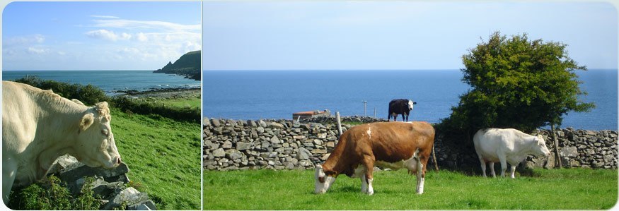
See the farm

Explore the area

Make a reservation
Your hosts

Meet your hosts, Mervyn and Joyce Norris.
This is page.php